RSS

The Temple Complex of Karnak in Luxor , Egypt

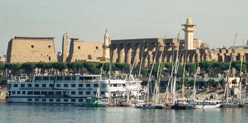
In ancient Egypt, the power of the god Amun of Thebes gradually increased during the early New Kingdom, and after the short persecution led by Akhenaten, it rose to its apex. In the reign of Ramesses III, more than two thirds of the property owned by the temples belonged to Amun, evidenced by the stupendous buildings at Karnak. Although badly ruined, no site in Egypt is more impressive than Karnak. It is the largest temple complex ever built by man, and represents the combined achievement of many generations of ancient builders. The Temple of Karnak is actually three main temples, smaller enclosed temples, and several outer temples located about three kilometers north of Luxor, Egypt situated on 100 ha (247 acres) of land. Karnak is actually the sites modern name. Its ancient name was Ipet-isut, meaning "The Most Select (or Sacred) of Places".


This vast complex was built and enlarged over a thirteen hundred year period. The three main temples of Mut, Montu and Amun are enclosed by enormous brick walls. The Open Air Museum is located to the north of the first courtyard, across from the Sacred Lake. The main complex, The Temple of Amun, is situated in the center of the entire complex. The Temple of Monthu is to the north of the Temple of Amun, and next to it, on the inside of the enclosure wall is the Temple of Ptah, while the Temple of Mut is to the south. There is also the small Temple dedicated to Khonsu, and next to it, an even smaller Temple of Opet. Actually, there are a number of smaller temples and chapels spread about Karnak, such as the Temple of Osiris Hek-Djet (Heqadjet), which is actually inside the enclosure wall of the Temple of Amun.

In the Great Temple of Amun, the Second Pylon of Karnak was built by Ramesses II. The Ptolemies did some extensive repairing and some new building on the center section. Curiously enough, they left the columns and the facade of the First Pylon unfinished and left the mud-brick ramp where it was at. The reason for the work being left unfinished is not clear.

The Hypostyle Hall is found after passing through the Second Pylon. The hall is considered to be one of the world's greatest architectural masterpieces. Construction began during Ramesses I's reign. He was the king who founded the Nineteenth Dynasty and was king for only one year. The work continued under Seti I (1306 - 1290 BC). Seti I also built the Temple of Abydos and many other temples. The hall was completed by Seti I's son, Ramesses II. The effects that are produced inside the hall are much different than they were originally. The huge architraves are not above the capitals that tower above. Toward the center of the hall several architraves and windows that have stone latticework still remain.

This small area can give one an idea of the builders' intent for the lighting effects. Some imagination is required here to appreciate what it must have looked like. The walls, ceilings and columns are painted with the natural earth tones. The light that was allowed in originally kept most of the hall in shadows. The hall ceiling was 82 feet high and was supported by 12 papyrus columns. The columns are made of sandstone and set in two rows of six. Each row is flanked on either side by 7 rows of columns that are 42 feet (12.8m) high. Each row has 9 columns, however the inner rows have 7 columns. The reliefs throughout the hall contain symbolism of Creation. The reliefs in the northern half are from the time period of Seti I and are obviously better done than those done by his son Ramesses II, which are in the southern half. Ramesses II's reliefs are cut much deeper than those of Seti's. This gives a much more dramatic light and shadow effect.


Plan of Karnak -  Consists of  The Temple Precinct of Mut

The outer walls of the Hypostyle Hall are covered with scenes of battle. Again, Seti I is to the north and Ramesses II is to the south. The scenes have long since lost their color that was painted and the outlines of the scenes have been blurred by the centuries of wind and sun. It is unsure whether the scenes of battle are based on historical fact or of ritual significance. It is thought that when the battle details are very precise, real events are most likely involved. Seti's battles take place in Lebanon, southern Palestine and Syria. The southern walls of Ramesses II have hieroglyphic texts which actually record details of the Hittite king and Ramesses II signing a peace treaty in the twenty-first year of Ramesses reign. This is the first evidence found for a formal diplomatic agreement and is certainly historical.

The Transverse Hall lies beyond the rear wall of the Hypostyle Hall. The wall is mostly ruined. With the Transverse Hall is a partially reconstructed Third Pylon of Amenhotep (Amenophis) III. The Transverse Hall has remains of the earliest sections of the Karnak complex that are still in existence.

Leaving the hypostyle hall through the third pylon you come to a narrow court where there once stood several obelisks. One of the obelisks was erected by Tuthmosis I (1504 - 1492 BC) who was the father of Hatshepsut. This obelisk stands 70 feet (21.3m) tall and weighs about 143 tons. During the centuries between Tuthmosis I and Ramesses VI, the kings of the time did more than their share of destroying and dismantling. This obelisk was never touched. The original inscription was left in its place. However, two kings did add their inscription on either side of the original. Beyond this obelisk is the only remaining Obelisk of Hatshepsut (1473-1458 BC). It is 97 feet (29.6m) high and weighs approximately 320 tons. Besides the Lateran obelisk in Rome, this is the tallest standing obelisk. The one in Rome is 101 feet (30.7m) high. Hatshepsut was a woman who dared to challenge the tradition of male kingship. She died from undisclosed causes after imposing her will for a time. After her death, her name and memory suffered attempted systematic obliteration. The inscription on the obelisk says, "O ye people who see this monument in years to come and speak of that which I have made, beware lest you say, 'I know not why it was done'. I did it because I wished to make a gift for my father Amun, and to gild them with electrum."


Tuthmosis III (1479-1425 BC) was Hatshepsut's successor. When he came to power, he built a high wall around her obelisk. This wall hid the lower two-thirds but left the upper towering above. It has been thought that this was an easier and cheaper way of destroying her memory than actually tearing it down and removing it. If Tuthmosis III had really wanted to destroy the obelisk, he would have certainly torn it down and removed it. Perhaps that was another reason for his building the wall. The top of the obelisk was visible for 50 miles (80 km). The pink granite for the obelisk was quarried at Aswan, which is several hundred miles south of Karnak. The stone was moved several miles over to the river and shipped down to Thebes. The setting of the stone is shown on reliefs as the pharaoh raising it with a single rope tied to its upper extremity. This is most probably symbolic, but may have been done this way with several hundreds of people pulling together. To the south of the standing obelisk is its companion which has fallen. It was also made of a single block of granite but is broken now.

The Sixth Pylon, which was built by Tuthmosis III, leads into a Hall of Records in which the king recorded his tributes. Very little remains of this archive beyond two granite pillars. Just beyond these pillars lies the Holy of Holies or sanctuary. Originally it was the oldest part of the temple. The present sanctuary was built by the brother of Alexander the Great, Philip Arrhidaeus (323-316 BC) who was the King of Macedonia. The present sanctuary was built on the site of the earlier sanctuary built by Tuthmosis III. The present sanctuary contains blocks from the Tuthmosis sanctuary and still contain Tuthmosis' inscriptions. The sanctuary is built in two sections.


The Precinct of Montu
The square northern enclosure is the smallest of the three precincts and its monuments are poorly preserved. It contains the main temple of Montu, several smaller structures, particularly the temples of Harpre and Ma’at, and a sacred lake. A structure thought to be a treasury built by Tutmosis I was discovered outside the east enclosure wall.


The Montu precinct is the most significant architectural complex north of the Amun-Ra temple. It was first built by Amenhotep III, on a podium, its masonry including blocks belonging to discarded monuments from Amenhotep I, Hatshepsut-Tutmosis III, Amenhotep II and Tutmosis IV. It includes other monuments besides the Montu temple.

Amenhotep III, the founder of the main Montu temple, built an enclosure wall around the Montu precinct. In its current state, the Montu precinct also includes several other temples and structures. The temple of Ma’at, the only one extant to this deity, leans on the rear side of the Montu temple. Largely destroyed now, it still preserves inscriptions of some of the viziers of Ramesses III and XI. A previous Ma’at temple apparently existed in this area, indicated by reliefs and stelae belonging to the reign of Amenhotep III. The trials of the accused tomb robbers were held in this temple.

The precinct also includes a temple of Harpre. The temple of Harpre is built along the east side of the Montu temple. The oldest part, the sanctuary on the south side, may date back to the 21st dynasty. Nepherites and Hakor of the 29th Dynasty built a hypostyle hall with Hathor capitals. A geographical procession formed part of the decoration of the hypostyle hall. An open court and a pylon were added to the north façade during the 30th dynasty. A subsidiary building in front of the pylon is known as the eastern secondary temple, and may be related to the cult of the bull of Montu.


The sacred lake on the west side may have been dug by Amenhotep III and restored by Montuemhat, who has a biographical inscription in the Mut temple. A "high temple" was erected by Nectanebo II as a storehouse for the offerings.

Lastly, six doors in the south wall of the Montu precinct lead to six chapels dedicated by Divine Votaresses of Amun to different forms of Osiris. The chapels are of Nitoqret, Amenirdis, an unattributed one, Karomama, and one from the reign of Taharka.

A dromos leading to a quay on a canal, which is no longer extant, completes the complex. The dromos is a stone-paved road leading from the gate of the precinct to a quay on a canal north of the site. The quay may be dated to the reign of Psamtik I. Two statues of Amenhotep III have been found broken and buried under a chapel in the middle of the temple dromos.

A copy of the "Restoration Stela" of Tutankhamun was erected here, as was a stela of Seti I, inscriptions of Ramesses II, Merenptah, Amenmesses, and Pinedjem. The eastern part of the temple collapsed at the end of the New Kingdom, and reconstruction was probably undertook by Taharka, who also built a great portico on the main façade. This was dismantled and rebuilt by the first Ptolemies.

Outside the temple precinct, a limestone gate of Hathshepsut and Tutmosisi III was usurped by Amenhotep II and completed by Seti I. Only two brick walls of the chapel dedicated to Osiris, by Taharka, where a statue of the goddess Taweret was found by Mariette. Farther west, a door of Ptolemy IV marks the entrance to a small temple of Thoth, now in ruins. In the northwest, a columned building consecrated by Nitoqret to the Theban triad has suffered. To the east of the Montu precinct, the remains of a building known as a treasury, built by Tutmosis I, have been excavated. It consisted of a barque station of Amun, storerooms and workshops. This treasury may be the oldest building on the site.

The oldest remains on the site of North Karnak date back to the end of the Middle Kingdom and belong to urban settlements, with mud-brick houses, granaries and workshops.

All these buildings are dedicated to Amun-Ra of Thebes, even if rare mentions of Montu have been found, mainly epithets describing various kings as beloved of Montu. The dedicatory inscription of the main temple attributes the sanctuary to Amun-Ra, Lord of the Thrones of the Two Lands, Pre-eminent in Ipet-Sut., and this inscription is confirmed by various minor monuments such as the obelisks, the two quartzite statues of Amenhotep III and other statues.

The first dedicatory inscription to Montu appears on the stela erected by Seti I in the court of the temple. From the reign of Taharka we have a comprehensive documentation in the decoration of the portico, stating that Montu, Lord of Thebes, is the main god of the temple. Scenes on the Ptolemaic gate of the precinct confirm this rank for Montu.


Precinct of Mut
The southern part of Karnak contains the temple of Mut, on the east bank of the Nile, more than 900 feet south of the temple of Amun-Ra. It is surrounded by a crescent shaped sacred lake called Isheru, and subsidiary structures, especially the temple of Khons-pekhrod, originally of the 18th Dynasty, and a temple of Ramesses III.


During the New Kingdom, Mut, Amun and Khonsu their son became the pre-eminent divine family triad of Thebes. The earliest reference to Mut, Mistress of Isheru, occurs on a statue of the 17th Dynasty. Inscriptional evidence also links the site to Mut in the early 18th Dynasty reign of Amenhotep I. The earliest, securely dated Mut Temple remains are no later than the reigns of Tutmosis III and Hatshepsut.

The temple of Mut was built by Amenhotep III, but here too the propylon in the enclosure wall is Ptolemaic, Ptolemy II Philadelphus and III Euergetes I, and there are later additions to the temple by Taharqa and Nectanebo I among others. Hundreds of statues of the goddess Sekhmet inscribed for Amenhotep III are in museums, but some are still on site, perhaps moved from the king’s mortuary temple on the West Bank.

Recent excavations indicate that much, and possibly all, of the present precinct was village settlement, until some time in the Second Intermediate Period.

Under Hatshepsut and Tutmosis III, the precinct seems to have consisted of the Mut Temple and the sacred lake and to have extended no further north than the temple’s first pylon. Parts of the west and north walls of these precinct have been uncovered, including a gate bearing Tutmosis III’s name and a Seti I restoration inscription. The eastern and southern boundaries of this precinct are as yet undefined.

The Mut Temple was enlarged later in the 18th Dynasty, when the Tutmoside building was completely enclosed by new construction, probably by Amenhotep III. The Mut temple’s present second pylon, of mud-brick, dates no later than the 19th Dynasty, and may have replaced an earlier precinct or temple wall. Its eastern half was built of stone late in the Ptolemaic period. The temple’s first pylon, also of mud-brick, has a stone gateway built no later than the 19th Dynasty, and displays at least one major repair. This pylon may also replace an earlier northern precinct wall. Also in the 19th Dynasty, Ramesses II rebuilt Temple A, which lay outside the precinct and which was already enlarged by Amenhotep III. In front of Temple A, Ramesses II erected two colossal statues, at least one usurped from Amenhotep III, and and two alabaster stelae recarved from parts of a shrine of Amenhotep II. One stelae indicates that Temple A was at that time dedicated to Amun.

Temple A was more extensively renovated during the 25th Dynasty, during which time it functioned at least in part as a birthhouse, celebrating the birth of Amun and Mut’s divine child, with whom the king was identified. A significant part of the Mut Temple was also rebuilt.

In the 25th and 26th Dynasties a proliferation of small chapels began. These include at least two dedicated by Montuemhat, an official in the reign of Taharka, a magical healing chapel dedicated by Horwedja, Great Seer of Heliopolis, a chapel related to Divine Votaresses, a small Ptolemy VI chapel, and Chapel D dedicated to Mut and Sekhmet, built by Ptolemies VI and VIII.

The massive enclosure walls built by Nectanebo II of the 30th Dynasty give the precinct its current shape and size, incorporating Temple C and a large area south of the sacred lake as-yet unexplored.


Temple of Amun-Ra
Pylon I, the entrance to the temple complex, is preceded by a quay, probably reconstructed during the 25th Dynasty and an avenue of ram-headed sphinxes, most of which bear the name of the high priest of Amun, Pnudjem of the 21st Dynasty. This pylon, which is unfinished, was probably built in the 30th Dynasty by Nectanebo I, though an earlier pylon may have stood here. South of the avenue are several smaller structures, including a barque shrine of Psammuthis and Hakoris, and parapets of the 25-26th Dynasties.


The court which opens behind this pylon contains a triple barque shrine of Seti II made of granite and sandstone, consisting of three contiguous chapels dedicated to Amun, Mut and Khonsu. In the center of the forecourt there are remains of a colonnaded entrance of Taharqa, one of the columns of which has been re-erected. A small temple or barque station, of Ramesses III faces into the forecourt from the south. This temple was a miniature version of the mortuary temple at Medinet Habu.

The doorway on the north side of this court leads to an open-air museum, where a number of small monuments have been reconstructed, including the limestone barque chapel of Senusret I and Hatshepsut’s Chapelle Rouge.

Pylon II, probably a work of Horemheb, is preceded by two colossal statues of Ramesses II. Only the feet of one remains. A third statue of the king includes Princess Bentanta standing between his feet. Behind the pylon, the now lost roof of the Great Hypostyle Hall, the most impressive part of the whole temple complex, was borne by 134 papyrus columns. The relief decoration of the hypostyle hall is the work of Seti I and Ramesses II. The exterior walls depict military campaigns of these kings in Palestine and Syria, including the Qadesh battle against the Hittites.

Pylon III was built by Amenhotep III, but the porch in front of it was decorated by Seti I, and Ramesses II. Numerous blocks from earlier buildings were found reused in the pylon: a sed-festival waystation of Senwosret I, the White Chapel, shrines of Amenhotep I and II, Hatshepsut, the Red Chapel, and Tutmosis IV, and a pillared portico of the same king. The four obelisks which stood behind the pylon were erected by Tutmosis I and III to mark the entrance to the original temple, but only one obelisk of Tutmosis I is still standing


Pylons IV and V, both built by Tutmosis I, and the narrow once-pillared area between them, are the earliest parts of the temple. Two obelisks of Hatshepsut made of red quartzite can be seen here, one still standing.

Further east is the Festival Temple of Tutmosis III. One room in this temple is known as the "Botanical Garden", because of its representation of exotic plants, birds, and animals., It may have contained the core sanctuary of the temple.

In the 20th Dynasty, Ramesses III built a triple barque shrine in the western court and undertook the construction of the temple of Khonsu.

Taharka in the 25th Dynasty built the large sacred lake with a temple, the lake edifice, at its north-west corner. He also built columned pavilions leading to the eastern and western entrances of the temple and in front of the temple of Khonsu. The small pylon of the temple of Opet was also begun during the 25th Dynasty.

The large gate of Ptolemy III Euergetes was built in front of the temple of Khonsu and at the back of the Opet temple. Extensive repairs were made to the bases of walls damaged where ground water had risen. Repairs were also made to the Hypostyle hall walls, and the eastern and western gateways were entirely redone

The court north of Pylon VII is known as the Cachette Court: Here a deposit of thousands of statues which originally stood in the temple was found in 1903.

Near the northwest corner of the temple’s sacred lake is a colossal statue of the sacred scarab beetle on a tall plinth, dating to Amenhotep III.

The temple of Khonsu stands in the southwest corner of the enclosure. Its propylon in the main enclosure wall, built by Ptolemy III Euergetes I, is approached from the south by an avenue of ram-sphinxes protecting Amenhotep III. The pylon was decorated by Pnudjem I , the forecourt by Herihor, an the inner part by various Ramessids. There is also some Ptolemaic relief work.

Nearly 20 other smaller chapels and temples are within the precinct of Amun-Ra, including one of Ptah built by Tutmosis III, Shabaka, several Ptolemies and Tiberius. A good example of these small temples is that of Osiris Hek-Djet.


The Akhenaten temples

Akhnenaten was second son and successor to Amenhotep III. He spent the first five years of his reign in Thebes, and he favored the sun shrine characteristic of the Heliopolitan center of solar worship, which featured open courts on a central axis. Smaller stones were used which a single man could carry. Tens of thousands of these in the best sandstone were quarried at Gebel el-Silsila, about 100 km south of Thebes.

These small blocks were recycled later as the sun temples were reduced, and used as fill or foundation in walls and pylons of the 19th Dynasty. Some have been found in Horemheb’s Pylons II and IX at the Amun temple at Karnak, as foundation blocks beneath the hypostyle hall of the Amun temple, and in Ramesses II’s pylon and outbuildings in the Luxor temple. Some survived to be used as late as the reign of Nectanebo I, and some turned up at Medamud in Ptolemaic period constructions.

Akhenaten erected four major structures at Karnak during the first five years of his reign. The major building was called "the Sun-disk is Found", built in anticipation of the jubilee; then there were the "Exalted are the monuments of the Sun-disc", and "Sturdy are the movements of the Sundisk." The smallest of the four was the Hwt-bnbn, "Mansion of the benben stone". A Hwt-itn, "Mansion of the Sun-disk", mentioned in tombs on the west bank, has not as yet turned up in the scenes on these blocks.

Only one of the four structures has been located and partly excavated. The main Aten temple was built to the east of Karnak. From the center of its western side ran a columned corridor 12 feet wide that led west to connect with the 18th Dynasty royal palace which lay just north of Pylons IV, V and VI of the Amun temple. There were probably life-size statues made of red quartzite representing the king, arms crossed, though other statues may have included the queen as well. Reliefs show the king with one arm outstretched and being caressed by the rays of the sun-disc.

In the Aten temple, the consistent theme was the celebration of the jubilee, or heb-sed. Scenes in the entrance corridor coming from the palace show the approach of the royal party, courtiers kissing the earth, men dragging bulls, etc. Turning right along the west wall, to the southwest corner and then east along the south wall, are reliefs depicting the ritual of the "days of the White Crown," when the king made offerings dressed as the monarch of Upper Egypt. It is presumed that similar scenes were depicted showing the King in the same ritual for the Red Crown and Lower Egypt.

The Hwt-bnbn, though to-date not found, is reconstructed in the scenes on the blocks featuring tall graceful pylons and walls. But the identity of the celebrant of the offering to the sun-disc is not Akhenaten, but instead, his wife Nefertiti.

The relief decorations of the two temples called "Exalted are the monuments of the Sun-disc," and "Sturdy are the movements of the Sundisk," both structures also as-yet undiscovered, show domestic apartments, rewarding of officers, and other scenes from domestic life.

After the fifth year of his reign, Akhenaten moved from Thebes to Amarna, the new city he had built, and work on Karnak ceased. The name of Amun was obliterated throughout Karnak and the Theban area.

The Karnak Temples are open from 6:30 am until 5:30 pm in winter and from 6 am to 6 pm during summer. Admission is LE1 20 for foreigners, LE 10 for foreign students, LE 2 for Egyptians and LE 1 for Egyptian students. Visiting the open-air museum, to the left of the second pylon, costs an extra LE 10. The museum contains a collection of statuary that was found throughout the temple complex. The ticket has to be purchased at the main Karnak ticket kiosk.

Karnak takes at least a half of a day just to walk around its many precincts and years to come to know it well.
There is also a Sound and Light Show at Karnak. The show starts with a historical introduction covering the birth of the great city of Thebes and erection of the Karnak temple. The show also narrates the glorious achievements of some great Pharaohs. The Spectators listen to a magnificent and poetic description of the artistic treasures and great legacy which the Karnak temple encloses.


Show
1st show
2nd show
3rd show
4th show
Monday
English
French
German
Spanish
Tuesday
Japanese
English
French
-
Wednesday
German
English
French
-
Thursday
Arabic
English
French
-
Friday
English
French
Spanish
-
Saturday
French
English
Italian
-
Sunday
German
English
Italian
French
Show "Winter"
6:00 P.M.
7:15 P.M.
8:30 P.M.
9:45 P.M.
Show "Summer"
8:00 P.M.
9:15 P.M.
10:30 P.M.
11:45 P.M.


Sound and Light Show Pricing

Ticket fare LE.30 plus LE 3 (Sales Tax) all versions. LE.10 for Arabic version for Egyptians and Arabs only plus LE 1 (Sales Tax).

Private shows are presented upon previous arrangement, Karnak for 100 spectators for lease (from October to March) and for 75 spectators (from April to September).

Ticket fare for private show LE 35 plus 3.5 (Sales Tax) plus LE 300 open Expense.

Russian show at Karnak are presented for 40 spectators by lease upon previous arrangement for the same price or ordinary ticket


Luxor Temple of Thebes in Egypt

The name Luxor represents both the present-day metropolis that was ancient Thebes, and the temple on the eastern bank which adjoins the town. "Luxor" derives from the Arabic al-uksur, meaning "fortifications". That name in addition was adapted from the Latin castrum which referred to the Roman fort built around the temple in the later third century AD. The temple of Luxor has, since its inception, always been a sacred site. After Egypt's pagan period, a Christian church and monastery was located here, and after that, a mosque (13th century Mosque of Abu el-Haggag) was built that continues to be used today.


In ancient Egypt the temple area now known as Luxor was called Ipt rsyt, the "southern sanctuary", referring to the holy of holies at the temple’s southern end, wherein the principal god, Amun "preeminent in his sanctuary", dwelt. His name was later shortened to Amenemope. This Amun was a fertility god, and his statue was modeled on that of the similarly Min of Coptos. He also has strong connections to both Karnak and West Thebes.

Known in ancient times as "the private sanctuary (Opet) of the south," the temple proper is located south of Karnak. The present temple is built on a rise that has never been excavated and which may conceal the original foundations. The early building may rest on a no longer visible older structure dating back to the 12th Dynasty. However, since neither the cult nor any part of the temple appears to predate the early 18th Dynasty; the few Middle Kingdom fragments found here more probably came from elsewhere and were transported to Luxor after the original buildings were dismantled.

The earliest reference to the temple comes from a pair of stelae left at Maasara quarry, in the hills east of Memphis, inscribed in regnal year 22 of the reign of Ahmose, c. 1550 BC. The text records the extraction of limestone for a number of temples including the "Mansion of Amun in the Southern Sanctuary." But structural evidence appears at Luxor only during the co-rule of Hatshepsut and Tuthmosis III c 1500 BC. These elements are now built into the triple shrine erected by Ramesses II, c 1280 BC, the most substantial remnant of Luxor temple’s Tuthmosid phase. The shrine was erected inside the first court, in the northwest corner, and reused elements from the original chapel dedicated by Hatshepsut and Tuthmosis III.. This small building had been the last of six barque stations built along the road that brought Amun and his entourage from Karnak to Luxor every year during the Opet Festival..

We also know that Amenhotep IV (Akhenaten) built a sanctuary to the sun next to the Luxor Temple that was later destroyed by Horemheb.

The temple we see today was built essentially by two kings, Amenhotep III, (the inner part), and Ramesses II, (the outer part). The overall length of the temple between the pylon and rear wall measures about 189.89 by 55.17 meters (623 by 181 feet).

The original function of the temple of Luxor, apparently dedicated to the Theban Triad of Amun, Mut and their son Khonsu, appears uncertain. However, recent hypotheses suggest that the temple of Luxor, a collection of irregularly developed structures begun during the reign of Amenhotep III and then expanded, particularly by Ramesses II, and still further enlarged in later years, should be considered a sanctuary dedicated to the celebration of the royal ka.

Hence, Luxor Temple was the power base of the living divine king, and the foremost national shrine of the king’s cult. This doctrine of divine kingship separated the Egyptians from their neighbors in Mesopotamia and from the later medieval "divine selection and right of kings" of Europe.


Plan of Luxor Temple

Kingship was believed to be ordained by the gods at the beginning of time in accordance with ma’at., the well-ordered state, truth, justice, cosmic order. The reigning king was also the physical son of the Creator sun-god. This divine conception and birth was recorded on the walls of Luxor Temple, at Deir el-Bahari, and other royal cult temples throughout Egypt. The king was also an incarnation of the dynastic god Horus, and when deceased, the king was identified with the father of Horus, Osiris. This living king was thus a unique entity, the living incarnation of deity, divinely chosen intermediary, who could act as priest for the entire nation, reciting the prayers, dedicating the sacrifices.


A road was built in the 18th Dynasty to link Karnak to the north with Luxor to the south. Although the position of this road must have coincided with the avenue seen in front of Luxor temple today, the latter, along with the sphinxes flanking it, date to the reign of Nectanebo I in the 30th Dynasty. However, we believe that Nectanebo I only refurbished the road and lined it with new sphinxes. The mudbrick ruins on either side of the road are all that remains of the town of Luxor during the later and post-Dynastic periods.

There was a girdle wall built around the temple that consisted of independent massifs of sun-dried brick abutting at their ends, built of courses set on a triple system that ran concave horizontal concave.

The gate through which one would pass from the avenue to the esplanade in front of the temple was constructed after the Dynastic period, for the brick wall around this courtyard is contemporary with the Roman fort built around the temple at the beginning of the 4th century AD. Substantial remains of the walls, gates, and pillared stone avenues, can be seen east and west of the temple. Buildings used in this transformation and which no longer exist in whole include a chapel dedicated to Hathor that was erected during the 25th dynasty reign of Taharqa and a colonnade of Shabaka, later dismantled. A modest mudbrick shrine dedicated to Serapis during Hadrian’s reign and which still contains a statue of Isis survives at the court’s northwest corner.


Two red granite obelisks originally stood in front of the first pylon at the rear of the forecourt, but only one, more than 25 meters (75 feet) high, now remains. The other was removed to Paris where it now stands in the center of the Place de la Concorde. These obelisks were not of the same height, and they were not on the ame alignment, probably to make up in perspective for this difference in height.

Six colossal statues of Ramesses II, two of them seated, flanked the entrance, though today only the two seated ones have survived. The one to the east was known as "Ruler of the Two Lands".

Although Amenhotep III built the temple proper, it is fronted by a 24 meter high pylon of Ramesses II. The pylon and the courtyard beyond, also built by Ramesses II, is oddly out of alignment with the axis established by the other pre-existent buildings. This non-alignment may have resulted from consideration for the small shrine built during the reigns of Tuthmosis III and Hatshepsut. Some scholars also think that the alignment may have been made so that the pylon would be on the same axis as the processional way leading to the Karnak Temple. Reliefs and texts on the outside of the first pylon relate the story, in sunk reliefs, of the battle of Qadesh against the Hittites. Other later kings, particularly those of the Nubian Dynasty, also recorded their military victories on these walls (Shabaka on the inner pylon walls). The pylon towers once supported four enormous cedar-wood flag masts from which pennants streamed.

Within the pylon is the Peristyle Courtyard of Ramesses II, a "feast court" (wsekhet khefet-her, "The Temple of Ramesses Meriamon united with eternity"), which is surrounded by two rows of papyrus bud columns with cylindrical shafts on all of its sides. It is not square, but rather in the form of a parallelogram, measuring 57 by 50.9 meters (187 by 167 feet). It is here, in the northeast corner, that an ancient church was located, on the ruins of which the more modern mosque was built. Also here is the shrine of Tuthmosis III and Hatshepsut, which originally consisted of three contiguous deep shrines for the barques of Amun, Mut and Khonsu, preceded by a porch with four columns. This structure was rebuilt at the same location by Ramesses II using elements from the earlier sanctuary. It was embodied in the courtyard portico, abutting on the inner face of the northwestern tower of the pylon. It was necessary for the columns nearest the shrine to be engaged in its walls resulting in a quite unusual type of column. On the outside walls of this court are depictions related to Ramesses II's campaigns against the Hittites in Syria.


Colossal granite statues of Ramesses II representing him striding with a diminutive Queen Nefertari were placed between the columns of the southern part of the Peristyle Courtyard. The colossus to the west was "Re'-of-the-Rulers", a name borne by other statues at Abu Simbel and the Ramesseum.


Amenhotep III built the temple proper, at the south end of the site in three phases, including the colonnade, the big second courtyard and the hypostyle hall. The processional colonnade of Amenhotep III runs for some 100 meters with seven papyrus columns on either side standing 19 meters high (62 ft 3 in). Two seated double statues of Amun and Mut are on the south side.

Here, the figure of Amenhotep III alternates with those of his successors on door-jambs and columns. Carving of the scenes and inscriptions on the walls behind the columns had barely been started when the king died and then the upheavals of the Amarna period hold. Work came to a stop at Luxor during the reign of Akhenaten, but afterwards Tutankhamun finished most of the interior carving. He died before the work was finished, and therefore Ay completed the decorations. However, Horemheb usurped these decorations so that Tutankhamun's name shows up only inte4rmittently under that of Horemheb. The few scenes still left in paint at the south end of the hall were finally completed in relief a few years later by Seti I. These scenes depict the Festival of Opet. Those on the west wall show a procession of barques from Karnak to Luxor, those on the east wall show the reverse journey. It is here that inscriptions mention the six way stations for the barque between Karnak and Luxor, each possibly having a repository chapel (men wahet, "way station"). This hall predates that of Karnak, and served as its architectural prototype.

Beyond the colonnade is the Great Sun Court of Amenhotep III’s temple, which measure about 45.11 by 56.08 meters (148 by 184 feet. The sun court is almost identical to the court in front of the inner part of Amenhotep III’s funerary temple in West Thebes. Both are slightly wider at the front then at the rear. This would have enhanced the depth of the perspective of the court by an optical illusion and added to its impact. It received decoration from the time of Amenhotep himself to that of Alexander the Great. The side walls retain some of their original coloring. It was here in Luxor that in 1989 workers found a deep pit containing a large quantity of statuary, buried probably in the 4th century AD during the installation of a cult of the deified Roman emperor. The cache, similar to one found in Karnak in 1903, included statues of gods, goddesses, queens, kings and kings as gods, as well as triads of divinities and royal groupings. The most amazing statue in this cache was a larger than life sized statue of Amenhotep III, carved from red-gold quartzite.

At the back of the Great Sun Court, at its southern end, a hypostyle hall is blended in almost imperceptibly. It is described as a hall of appearance (wsekhet kha'it). It consists of four rows of eight bundle papyrus columns that once supported a now non-existent roof. Through the center of these columns runs an aisle. On the walls of this chamber Amenhotep III is depicted before the gods of Thebes ceding the temple above a plinth of figures personifying the Egyptian nomes.


This hypostyle hall leads to a smaller eight columned hall or portico which originally opened into the inner temple, but which was transformed by the Roman legion stationed at Luxor into a chapel dedicated to the imperial cult. At that time, the columns were removed. It contained the standards of the legion, and its south doorway was blocked with an apse painted with figures Emperor Diocletian, c 284-305 BC, and his three coregents, There is also a stairway in the chamber, and it is flanked by chapels dedicated to Mut and Khonsu.

In turn, this hall leads to two square halls, each originally having four columns, following one behind the other. To the east of the first of these halls is the "birth room", so called because of its decorative sequence. It is dedicated to the theogamy or marriage of Amun with Queen Mutemuya, the mother of Amenhotep III, represented in low-relief scenes similar in subject to those of Hatshepsut's temple at Deir el-Bahari. This was the "divine marriage" that was celebrated between the god and the queen, or "God's wife", during the Opet Festival. On the west wall is depicted the divine conception and birth of Amenhotep III, along with his subsequent presentation to the gods and nurturing, as well as the determination of the future king's realm. These scenes affirm the overall theme of renewed royal and divine vitality celebrated in the festival. The mound on which this area of the temple stood was also held to be the very site of the birth of Amun so that the theme of birth was clearly one shared by temple and festival alike.

The second four columned hall originally built by Amenhotep III no longer contains its columns, though the column bases may in fact still be seen. This was a barque chapel that was later converted into a shrine built by Alexander the Great and dedicated to the ithy-phallic Amun. Its scenes represent Alexander, dressed as a pharaoh, entering, receiving the two crowns, and offering rites. To either side of this small chamber were side chambers with three columns and an outer series of four contiguous cells.

When Amenhotep III built this section of the temple, the remaining part of it at the rear, was accessible through a side doorway in the east wall of the rear hall. Later, a central doorway was opened behind the stand for the barque in the barque shrine, in the axis of the temple plan, where there was once a gigantic false door that symbolically connected the two sections. This arrangement of two separate sanctuaries, the one in front made accessible to the people and the one to the rear reserved only for the priests, is one of the characteristics of this temple The chambers beyond the barque shrine, originally separated form the front part, formed a sort of temple within the temple, apparently with special mythic significance related to its particular version of Amun.

Above the lintel of the doorway connecting the barque shrine with the rear of the temple, concealed by removable slabs and accessible by holds cut in the wall, was a small chamber probably for oracular pronouncements.


Directly behind the barque shrine (south) are the innermost chambers of the Amenhotep III temple. The first of these chambers is a broad "hall of the offering table" (wsekhet hetep), with twelve columns, which actually proceeds the the shrine of the statue. The twelve columns possibly symbolize the hours of the day since depictions of the sun-god's day and evening barques appear on the room's opposing east and west walls (and in fact, the chamber is often referred to as the "Hall of Hours").


The twelve column broad hall is flanked by two small rooms, the eastern one being in fact a smaller "hall of the offering-table".

Beyond the twelve columned broad hall, in the central location, is the original sanctuary or "holy of holies", containing the base of the block which once supported the god's image. The seated statue of Amun was of colossal proportions, placed on a socle abutting on the rearmost columns, like the socles of thrones in temple palaces. There were two lateral balustrades. This is represented in low relief in two scenes flanking the entrance doorway to the rear shrine.

About this room are other chambers that form the suite of private or intimately secluded chambers which gave the temple its name of Opet or "harem". Here, we find niches that contained the statues of other divinities. These innermost parts of the temple stood on a low mound which was thought by the ancient Egyptians to be either the original site of creation, the mound which rose from the primeval waters, or at least symbolic of that place. Hence, the roles of the chief gods Amun and Re and the concepts of creation and cyclic solar renewal were here particularly intertwined.

The outer surfaces of the eastern walls of the inner temple area can be seen to contain many blocks apparently randomly decorated with unrelated images. This area represents a practice wall where the ancient masons and sculptors learned the skills of temple decoration. These surfaces were then plastered over, only to be revealed again in the course of centuries as the underlying stone became exposed.

Luxor East Bank , Egypt

The East Bank of Luxor refers to the central part of Luxor township, centred on the twin foci of the Temple of Luxor and the Temple of Karnak. Unlike the West Bank, which was ever the main area for cemeteries and mortuary temples, the East Bank represented the main settlement of the living throughout the millennia - a role that has hardly changed. The vast majority of hotels and tourist facilities are to be found in the East Bank.

Luxor , Egypt

Luxor ( in Arabic: الأقصر al-Uqṣur) is a city in Upper (southern) Egypt and the capital of Luxor Governorate. The population numbers 376,022 (1999 survey), with an area of approximately 416 square kilometres (161 sq mi) . As the site of the ancient Egyptian city of Thebes, Luxor has frequently been characterized as the "world's greatest open air museum", as the ruins of the temple complexes at Karnak and Luxor stand within the modern city. Immediately opposite, across the Nile River, lie the monuments, temples and tombs on the West Bank Necropolis, which include the Valley of the Kings and Valley of the Queens. Thousands of international tourists arrive annually to visit these monuments, contributing a large part towards the economy for the modern city.


Luxor has often been called the worlds greatest open air museum, as indeed it is and much more. The number and preservation of the monuments in the Luxor area are unparalleled anywhere else in the world that know of. Actually, what most people think of as Luxor is really three different areas, consisting of the City of Luxor on the East side of the Nile, the town of Karnak just north of Luxor and Thebes, which the ancient Egyptians called Waset, which is on the west side of the Nile across from Luxor.

Memphis, Egypt

Memphis (Arabic: منف‎) was the ancient capital of the first nome of Lower Egypt, and of the Old Kingdom of Egypt from its foundation until around 2200 BC and later for shorter periods during the New Kingdom, and an administrative centre throughout ancient history.

The Pharaonic Village in Cairo , Egypt


The Pharaonic Village was founded by Dr. Hassan Ragab Ph.D., who was the person who rediscovered the ancient Egyptian art of paper – making (Papyrus).


The Pharaonic Village is Egypt's historic park. It's a unique place where Egypt's entire history is explained in 2 to 3 hours including our ancient history as well as our modern history. Visiting The Pharaonic Village is recommended to be at the beginning of the trip to Egypt. It is located on an island in the Nile, just 3 miles south of the center of Cairo. In this village you are transported by floating amphitheaters, and a hundred actors and actresses demonstrate scenes from ancient Egypt (Papyrus making, sculpting, home building….etc.).

Abdeen Palace Museum, Cairo, Egypt

Abdeen Palace (Arabic: قصر عابدين) is one of the official residences of the President of Egypt.


Address: Moustafa Abdel Raziq Street, off Abdeen Square,


Zone/Area: Cairo


Phone: +20 2 391 0042


Construction


Construction started in 1863 and continued for 10 years but the palace was officially inaugurated in 1874. Erected on an area of 24 feddans, the palace was constructed by the French architect Rousseau along with a large number of Egyptian, Italian, French and Turkish decorators. However, the palace’s garden was added in 1921 by Sultan Fuad I on an area of 20 feddans. The cost of building the palace reached 700,000 Egyptian pounds in addition to 2 million pounds for its furnishing. More money was also spent on the palace’s alteration, preservation and maintenance by consecutive rulers. The palace includes 500 rooms.

Khan el-Khalili bazaar Market in Cairo , Egypt

How could a market in Egypt be responsible for the founding of the United States? Khan el-Khalili, once known as the Turkish bazaar during the Ottoman period, is now usually just called the 'Khan', and the names of it and the Muski market are often used interchangeably to mean either. Named for the great Caravansary, the market was built in 1382 by the Emir Djaharks el-Khalili in the heart of the Fatimid City. Together with the al-Muski market to the west, they comprise one of Cairo's most important shopping areas. But more than that, they represent the market tradition which established Cairo as a major center of trade, and at the Khan, one will still find foreign merchants. Perhaps, this vary market was involved in the spice monopoly controlled by the Mamluks, which encouraged the Europeans to search for new routes to the East and led Columbus, indirectly, to discover the Americas. During its early period, the market was also a center for subversive groups, often subject to raids before the Sultan Ghawri rebuilt much of the area in the early 16th century. Regardless, it was trade which caused Cairo's early wealth, even from the time of the Babylon fort which was often a settlement of traders.

Al-Azhar Park in Cairo

The Al-Azhar Park is important for tourists to Egypt because this hilly site is surrounded by the most significant historic districts of Islamic Cairo. This is one of the primary destinations for many visitors to the city, and this new park located in its heart provides many advantages, including a wonderful view of the surrounding area.


The creation of the 30 hectare (74 acre) Al-Azhar Park on Al-Darassa, by the Aga Khan Trust for Culture, came when his highness the Aga Khan decided to donate a park to the citizens of Cairo in 1984, out of the Islamic belief that we are all trustees of God’s creation and therefore must seek to leave the world a better place than it was before us. This decision was made during the 1984 conference “The Expanding Metropolis: Coping with Cairo’s Urban Growth.”

The Cairo Tower in Cairo, Egypt

Its nice to be up high in Cairo. It gives one a prospective view of this great city, with it's very modern and very ancient districts. Anyone who has stood atop the Citadel or from the upper floors of some of the taller hotels is aware of the grand views that Cairo offers.


One of the best views is from the Cairo Tower, located on Gezira Island (Zemalak) just north of the Museum of Modern Art (which is also very much worth a visit), which provides a panoramic vision of Cairo. This 187 meter tall tower, in the form of a latticework tube that fans out slightly at the top, is said to imitate a lotus plant, and ranks only fourth among the worlds highest towers. It is made of granite,  the same material often used by the ancient Egyptians, and is about 45 meters taller than the Great Pyramid at Giza.

Ibn Tulun in Cairo, Egypt

Tulun himself was a Turkish slave from Bokhara who was given to Caliph Mamun in 815 AD as a present. Afterwards, he became a powerful and influential person in the court of Mamun, allowing his son Ahmad Ibn Tulun (ibn means son of) to be well educated in the best traditions of Islamic law and government. As a young man, Ahmad was a loyal servant to his caliph in Samarra (north of modern Baghdad), Mesopotamia and when his father died and his stepfather was given Egypt as a sort of private estate by the caliph, Ahmad Ibn Tulun was sent to administer the country.


Ibn Tulun's appointment as prefect of Egypt came in 868 and at the end of a long period of political strife. The Bashmurite rebellion of 832 in the Nile River delta between the river's Rosetta and Damietta branches was the last and most violent of the Christian uprisings in Egypt. Caliph Mamun himself has spend forty-nine days in Egypt taking part in its suppression. Maqrizi, a well known historian of that period, says that, "From then on, the Copts were obedient and their power was destroyed once and for all; none were able to rebel or even oppose the government, and the Muslims gained a majority in the villages". In 853 the Byzantines successfully attacked Damietta, and then from 866 to 868 AD and Arab-led revolt smoldered in a vast region of the delta and Fayoum.

When he arrived in Askar-Fustat (which would one day spawn Cairo), at about the age of thirty-three, it is said that he was unable to even pay his way from Baghdad to Egypt. He had to borrow ten thousand dinars to set himself up in his new position. That soon changed, however, for by 870 he was well enough off to build his own capital, because old el Askar was too small for his entourage of soldiers, ministers, wives and slaves.


Ibn Tulun created a small kingdom of his own out of a united Egypt and Syria, which he captured in 878, and with this combination behind him he almost conquered Mecca. For the first time since the Roman conquest, Egypt would constitute, in the reign of Ibn Tulun and his successors, an autonomous state, albeit under Abbasid suzerainty. The caliphate was weak, and it was obviously silly to Ibn Tulun to send all his Egyptian revenue east. Hence, much of the revenue was kept in Egypt for the first time in many hundreds of years. Fustat at this time remained an important and large trading port between Egypt and the east, and Ibn Tulun was intelligent enough to keep this trade active. Therefore, he gained the money and power to build his new capital.

He built this city on a little knoll of high ground between Fustat and the Mukattam Hills, called Yeshkur. The political power of the Tulunids, the flowering of their art and the pomp of their court life were expressed in this new capital. Today, this area of the city is not difficult to find, for atop the little hill Ibn Tulun built his famous mosque which has survived the devastations of time. The new city was built just northeast of el Askar and its boundaries were the Mosque of Ibn Tulun on the east, Birkat al-Fil (Pond of the Elephant) to the north and the sanctuary of Zayn el Abidin to the south. It has been estimated that the new city took up some 270 hectares of land.

It is said that this was a Christian cemetery where Moses was supposed to have had a conversation with God, and where Abraham slew his sacrifice. Muslims considered it a holy place, since Christians and Jews were both respected by Islam as "people of the Book". However, Ibn Tulun cleared the Christian graves from the area and built his royal capital around the hill. This new town was divided into special katais (districts) for each segment of the population who came there to live. Each of these districts was then named according to the kind of population, consisting of servants, soldiers, guards, Romans (actually Greeks) or Nubians. Hence, the city was called Katai (al-Qatai, the districts, the wards or the plots). This by the way was a tradition from Samarra, which was likewise divided into districts. There, Ibn Tulun built a palace (qasr) at the foot of the Mukattam Hills, a garden, a racecourse and polo grounds, a zoo, a palace for his wives, baths, a hospital and rich houses for his staff. A road led from the palace and the square to the mosque and the "Main Avenue (Shari el Azam), which possibly coincides with that would become Saliba Street. Now the city that would become Cairo consisted of three capitals built by three rulers, consisting of Askar, Fustat and Katai, and with Ibn Tulun, it began to take on the decorative style that made it a genuinely fabulous place.


The nerve center of this new royal city was his Midan el Katai, which was a huge square which extended more or less from the present citadel right up to the hill of Yeshkur. This square may occupy today what is Rumayla Square. Ibn Tulun was a great horseman and an enthusiastic soldier, so he used the midan for parades and polo, and the historian Makrizi says that everybody in Fustat loved this big square. If one asked a passerby where he was going it was usually to the midan, for there was always something going on there, even at night.

El Katai was surrounded by a network of narrow streets and it is said that there were eventually a hundred thousand houses in this city. It had lush gardens and zoos, along with many gates (said to be nine) into the square. Each of the gates had a special meaning and each a special name. One could only enter by the gate of ones class or profession, though who classified this large population we really don't know. There was a Gate of Nobles and a Gate of Lions, surmounted by two carved lions, and a gate called el Darmun because that was the name of the captain of the guards. Ibn Tulun himself entered through a special tri-arched gate of his own known as the Hippodrome, and when he reviewed his troops he would lead them through the center of it while up to thirty thousand men would pass through the side arches.

Of the palace that Ibn Tulun built nine years earlier than his mosque, nothing now remains, for his later rivals razed it to the ground. Surviving sources indicate that it was built to challenge the splendors of Samarra, and like the palaces of the city, it to was immense in size and boasted gardens. The palace was located next to the Hippodrome and was known as the 'Palace of the Hippodrome'.

Ibn Tulun would sit in a little summerhouse he had built high up on the Gate of Lions and at night, look down on his square which would always be filled with people and lights. Particularly on feast days, there would be considerable gaiety. By simply turning around, he could see the Mukattam on one side and the Nile on the other. In fact, the whole conception of this midan implies a rich and prosperous population, as well as one that was not under too much restraint.


The hospital that Ibn Tulun built between 872 and 874 AD, known as a muristan, could be counted as modern even now. One would leave their own clothes when entering it and put on hospital garments. All food and medicines were free, and Ibn Tulun inspected the hospital every Friday. This hospital was built specifically for the general population, and in fact his soldiers and guards were forbidden from its grounds. Tradition holds that the hospital was built with money (60,000 dinars) from a treasure trove found by one of Ibn Tulun's servants in Upper Egypt. The servant was riding in the country one day when his horse fell into a hole, and in the hole they found treasure worth a million dinars. This is not an uncommon story in Egypt, for more than one treasure has been discovered in this manner. The hospital was further endowed with the inalienable right to the profit from the slave market and other large and prosperous markets.

To supply this new city with water, Ibn Tulun built an aqueduct, at a cost of 40,000 dinars, of which several arches are still extant between Birkat el Habash and the palace.

The mosque that Ibn Tulun built and which survives in Cairo must be one of the most beautiful and stimulating monuments any historical figure has ever managed to leave behind him. Its intrigue is only matched by a story about its founding. It is said that Ibn Tulun did not want to rob any more Christian churches of their columns because he thought it sacrilegious. However, he required a mosque of considerable size. Hearing of Ibn Tulun's problem, a Christian who was in jail for some minor offense offered to build a very large mosque with no columns, and he sent Ibn Tulun an outline showing a vast enclosed courtyard with the mosque itself held up not by marble columns but by squat brick piers supporting pointed arches. Ibn Tulun immediately grasped the inventiveness of the idea and freed the Christian, paying him 110,000 dinars for his work, which was not bad considering the mosque itself cost only 120,000 dinars.


This is a good story but scholars doubt its validity, believing rather that it was told to explain the use of brick piers, which had never before been seen in Egypt. However, fire was probably a concern, and marble disintegrates under flame, while brick does not. Another factor is that at Samarra, in the Tigris River basin, buildings were made from clay, so this would also explain the use of brick. Brick must be very cleverly used to be both imposing and beautiful, and there is something so powerful and individual in those brick piers, even now, with the famous pointed arches rising over them like a ballerina's swanlike arms, that even a layman can see the originality of this unusual design. This mosque was the first to use the pointed arch in a vast architectural complex, and it would be another two hundred years before Christians would borrow it for their own Gothic arch. The cloisters were also born in this kind of four-walled, colonnaded mosque. The whole concept of this complex, brilliant it would seem in almost every brick, probably owned its design not to a jailed Copt, but to mosques already standing in Samarra, but in style at least it is wholly Egyptian.

Ibn Tulun was not yet fifty when he got dysentery from drinking too much milk. He was in Anticon on a military expedition at the time, and was carried home to Fustat on a camel litter. His doctors put him on a diet, but he became violent and refused to obey them. In fact, when he was dying he had his doctors flogged to death for their failure, and by 884, he was gone.


Regrettably, Katai was a dynastic city that did not long survive the Tulunids who built and inhabited the city. The traveler Ibn Hawqal, who describes Fustat around 969, mentions its disappearance when he writes, "Outside Fustat, there used to be constructions built by Ahmad Ibn Tulun over an area of a square mile where his troops were quartered, and it was called Qata'i. It was comparable to Raqqada, which the Aghlabids founded outside Qayrawan. Both of these sites have today fallen into ruin. Of the two, Raqqada was stronger and better appointed". Simply put, Katari was too distant from the Nile, and could not develop as an autonomous economic center.

What to See


The entire complex of the Mosque of Ibn Tulun is surrounded by a wall and covers more than 6 acres. With an area of 26,318 sq m, the mosque itself is the third largest in the world.

The arches of the courtyard galleries are decorated with beautifully carved stucco, the first time this medium was used in Cairo.

The minaret, the only one of its kind in Egypt, is modeled after the minarets of Samarra, with a spiral staircase around the outside. Andalusian influence can also be seen in the horseshoe arches of the minaret windows and elsewhere - this was brought to Egypt by Muslim refugees who were driven out of Spain by the Reconquista .

The mosque has been restored several times. The first known restoration was in 1177 under orders of the Fatimid wazir Badr al-Jamālī, who left a second inscription slab on the mosque, which is noted for containing the Shī'ī version of the shahada, adding the phrase "And Ali is the wali of God" after acknowledging the oneness of God and the prophethood of Muhammad. Sultan Lajīn's restoration of 1296 added several improvements. The mosque was most recently restored by the Egyptian Supreme Council of Antiquities in 2004.

During the medieval period, several houses were built up against the outside walls of the mosque. Most were demolished in 1928 by the Committee for the Conservation of Arab Monuments, however, two of the oldest and best-preserved homes were left intact. The "house of the Cretan woman" (Beit al-Kritliyya) and the Beit Amna bint Salim, were originally two separate structures, but a bridge at the third floor level was added at some point, combining them into a single structure. The house, accessible through the outer walls of the mosque, is open to the public as the Gayer-Anderson Museum, named after the British general R.G. 'John' Gayer-Anderson, who lived there until 1942.

Ben Ezra Synagogue, Cairo , Egypt


The Ben Ezra Synagogue in Cairo is located behind the Hanging Church and was once a church itself.

The Ben Ezra Synagogue was originally a Christian church, which the Coptic Christians of Cairo had to sell to the Jews in 882 AD in order to pay the annual taxes imposed by the Muslim rulers of the time. The church was purchased by Abraham Ben Ezra, who came from Jerusalem during the reign of Ahmed Ibn Tulun, for 20,000 dinars.

The synagogue was a place of pilgrimage for North African Jews and the site of major festival celebrations. The famous medieval rabbi Moses Maimonides worshipped at Ben Ezra synagogue when he lived in Cairo.

The Monastery and Church of St. George (GREEK ORTHODOX) in Coptic Cairo , Egypt

The image of St George as a Roman soldier mounted on a fine Arabian horse and spearing a dragon is a familiar one throughout Old Cairo, where there are two facilities dedicated to him. Throughout the Christian East, Saint George is undoubtedly the most popular warrior-saint, and in the Coptic churches of Cairo there are now more than twenty relics of the equestrian saint.
The Coptic biography of Saint George does not mention his flight with and victory over the dragon. Hence, scholars believe that around the fourteenth century this theme was a transferal from the biography of St. Theodore Stratelates to Saint George, though it is also possible that the Copts adopted this tale from the Western Christians.


The origin of he monastery of St. George (Deir al-Banat), located in Old Cairo, is obscure, but it is believed that the foundation of the structure dates from the seventh or eighth century. Today, the monastery is actually home to between thirty and forty religious women.

St. George Convent in old Cairo , Egypt

Old Cairo comprises six ancient churches, a Jewish Synagogue which was previously a Coptic church named after the angel Gabriel, the Coptic Museum and our convent, St. George.


These are the words spoken by our Lord Jesus Christ to St. George before his martyrdom. From the manuscript of St. George kept in St. George’s Convent in Old Cairo:

“I swear by myself, my beloved George, that as there was no one borne of woman greater than John the Baptist, also no martyr resembles you. You will have no counterpart among them. I made your name spread in my kingdom and gave it grace and made it a port of safety for all mankind. Whoever, in distress, calls on your name, either man or woman, I will quickly answer and give them their heart’s request.”

Saint Barbara Church in Coptic Cairo , Egypt


The Coptic Orthodox Church of St. Barbara (or Sitt Barbara) is one of the many famous Coptic Orthodox parishes that can be found in the district of Coptic Cairo. The building is located on the eastern part of the Babylon Fortress and is one of the oldest buildings in Cairo, dating back to the 5th or 6th century AD. However, like many other buildings of Coptic architecture, it was rebuilt several times, most notably by the end of the 11th Century.